
About Chile
An eventful story: The birth of the country.
Nowadays there is a lot of talk about migrants. But since his appearance on Earth, has man not always been a migrant?
According to some theories, there may have been inhabitants in South America 40,000 years ago, but this is not proven; what we know for sure is that after crossing the Bering Strait about 14,000 years ago, some of them gradually descended into the territory of present-day Chile 12, 11, 10,000 years ago; In those days, there were no planes, no ships, no trains, not even domesticated horses!
Thus, in the north, the Atacamas, the Aymaras, farmers and shepherds, the Diaguitas, who were not only potters, and the Changos, nomadic fishermen of the coast, settled.
In the Central Valley, they are the Mapuche, “people of the land.”
Time flies… Here we are about 6,000 years ago…
Further south, the Huilliches, a forest and agricultural population, also inhabit the Chiloé archipelago, with the Chonos, nomads of the seas who descended from their boat (the dalca that gave its name to the Dalcahue people) according to food resources.
This region is also home to the Aonikenk or Tehuelches: large nomadic herders whom the first explorers called “Patagonians”.
Even farther away, the Alacalufes are hunter-fisher-gatherers, near the Strait of Magellan.
On the islands of Tierra del Fuego, the Selknam, Yaganes or Yamanas, in their lenga bark canoes, hunt birds and marine animals whose skin they use.
Not everyone lives in perfect neighbourly relations… and already in the 15th century, the Incas of Peru occupied the Atacama region and even the central region, but the resistance of the Mapuche forced them to leave less than 100 years later. Then everything will change after the arrival of the “old world” explorers.
In the 16th century, on November 1, 1520, the Portuguese navigator Magellan, on the initiative of King Charles I of Spain, was the first European to arrive there. The storms in the strait that later took his name were so violent that he named the ocean where he arrived at the exit Pacific.
Attracted by the legend of El Dorado, in 1535, Diego de Almagro began the conquest of the territory, but in the south, the Mapuche resisted again and the conquistadors abandoned the place; until the eighteenth century, they remained only on the island of Chiloé.
In 1540, Pedro de Valdivia also traveled through Chile, where he founded Santiago (1541), Valparaíso (1544), Concepción (1550), and Valdivia (1552).
These foreigners are not welcome, it must be said that they kidnap people for the purpose of slavery. And this culminated in the Battle of Curalaba in 1598: the villages south of the Biobío River were destroyed.
In 1683, the abolition of slavery did not prevent the continuation of the clashes and the fierce resistance of the Mapuche… One of the longest “wars” in human history. Until the mid-nineteenth century, the Biobío River marked a separation between the colonial government and the Amerindian ethnic groups.
Little by little, Chile regained its independence from Spain, taking advantage of the arrest of King Ferdinand VII by Napoleon in 1809; it was proclaimed on September 18, 1810; but in 1814, in Rancagua, it was reconquered. Bernardo O’Higgins allied himself with the Argentinian José San Martín, the separatists organized the Battle of Chacabuco in 1817; and it didn’t really happen until 1818 with the victory of Maipú.
From 1823 to 1831, a period of anarchy succeeded the authority of Bernardo O’Higgins.
From 1831 to 1871, the Conservatives returned to power and promulgated a constitution (1833).
From 1871 to 1891, a coalition of liberals and radicals ruled the country and participated in the War of the Pacific.
In the mid-nineteenth century, huge deposits of saltpeter were discovered in the Atacama Desert, then a rather Bolivian and Peruvian territory. It is interesting as a fertilizer for farmers and as a gunpowder component for the military. In 1879 war was declared and Chile occupied Antofagasta. Two years later, troops arrived at the gates of Lima and annexed the provinces of Tarapacá, Arica, and Tacna.
Bolivia is no longer accessible to the sea!
The Chilean victory initially benefited the British, who bought the saltpeter deposits at a low price.
But for Chile, copper is going to be an important economic resource with the world’s largest mine at Chuquicamata.
Who, for his part, is this French adventurer who landed in 1858?
Orélie Antoine de Tounens took advantage of the hostility of the Mapuche and had himself proclaimed king of Araucanía and Patagonia under the name of Orélie Antoine.
He assembled an army of 40,000 men and declared war on Chile.
Taken prisoner after a few years, he was condemned and exiled to a French warship. But even today, some of their descendants aspire to the throne and call themselves “Princes of the Kingdom of Patagonia and Araucanía.
A history also tormented by nature: the territory is located at the meeting point of the “Nazca” and “South American” tectonic plates. Up to a certain intensity, here we only talk about “shaking” and we don’t pay attention to it, but the strongest earthquakes, the “earthquakes”, cause significant damage: for example, the one on December 16, 1575, followed by a tsunami, destroyed the cities of Valdivia, Villarrica and Castro.
Economic resources:
Let’s follow the same path as the first settlers of the territory, but more than 10,000 after them.
Let’s enter the country from the north, and see what Chileans live on, what they live on today.
We arrive at the Atacama Desert, which encompasses several administrative regions.
Inside, where do these jeeps with a big red flag go? Towards copper mines: the first national resource and world leader: 36% of the world market with a production that varies depending on the year between 5,600,000 and 5,800,000 tons.
Lithium, which is very important for our batteries, accounts for 56% of global production at 147,000 tonnes. Molybdenum is second only to China with 58,000 tonnes per year.
It is followed by silver, gold, manganese, rhenium and selenium.
On the Pacific coast, it’s fishing: anchovy, horse mackerel and mackerel account for 46% and molluscs, including mussels, 82%.
94% of the annual production, i.e. 1,716,692 tonnes, is exported, as well as 76% of fishmeal.
And in all these regions, tourism, especially “adventure” tourism, creates a wealth of activities. (Chile as a whole is the world leader in adventure tourism, this represents the 4th largest GDP).
Along the Pacific coast, fishing and shellfish activities continue.
Among the cochayuyo algae are the black huiro, the palo huiro, the sarazo and the red algae “gracilaria chilensis”. The harvest, which is 1,800 tons per year throughout the country, is becoming increasingly lucrative, and given the growing demand, it is becoming a conversion for some fishermen. They are used in the food industry and in the kitchen in the form of a natural gelling agent. (Hagar-Hagar)
And we arrived in the Central Region. To the west of Santiago in the Casablanca Valley, to the south in the Maipo Valley, among others, we pass through vast orchards and large wine estates.
Chile is the world’s 4th largest exporter of fresh fruits and vegetables. For example, grapes reach a production of 2,000,000 tons, apples 1,700,000 tons, kiwifruit 230,000 tons, and there are also peaches, plums and hazelnuts.
It ranks 5th in the world in the export of wines: Carmenere, Cabernet Sauvignon, Chardonnay…
Agriculture across the country employs 13% of the working population.
Let’s continue further south: in the Bío Bío region there are fish processing plants: 1,716,692 tonnes of salmon, horse mackerel, trout and fishmeal are exported.
We also enter the forest areas: 2,302,356 hectares are dedicated to them throughout the country, but unfortunately these are monospecific plantations of pine and eucalyptus to the detriment of deciduous trees and protected species such as larch.
The “Valdivian Forest” is in decline, but it is the 2nd largest source of export along with cellulose, sawn timber and wood chips.
Moving towards the Lake District and Patagonia, the flatter land between the Cordillera and the ocean allows the cultivation of wheat (1,400,000 tons per year), corn (1,100,000 tons), oats, vegetables such as beans and asparagus.
Thanks to the humid climate, it is also a grassland area: dairy cows (about 620,000 head), beef cows and poultry are also raised, and there are already more sheep on the island of Chiloé.
On the coast, salmon, shellfish and crustacean aquaculture and seaweed harvesting are becoming increasingly important. In Puerto Montt, Aquasur is the largest aquaculture exhibition in the southern hemisphere.
Finally we reach Patagonia to the south, the Strait of Magellan and Tierra del Fuego.
Here the ranches are huge, almost only the sheep can find sustenance.
The port of Punta Arenas had its beginnings with the transport of wool. Currently, large shipments of wood and wood products are also leaving Tierra del Fuego; It is also the stopover for many cruise ships.
What a trip! And what a variety!
Contemporary history:
In 1891, a parliamentary system triumphed over the presidential system. During World War I, Chile experienced a period of prosperity thanks to its mineral wealth.
But in 1925, the army re-established the presidential system.
From 1938 to 1952, the entry of the middle classes into political life brought to power the governments of the Popular Front and the center left.
From 1964 to 1970, the Christian Democrat Eduardo Frei Montalva succeeded the conservative Jorge Alessandri.
In 1970, Salvador Allende won the presidential election, but did not have a parliamentary majority. He ruled by decree and undertook land reforms, nationalization of businesses and companies, including 9 out of 10 banks and copper mines.
His reforms were rejected by the right party, except for the nationalization of copper, which was approved on July 15, 1971. The opposition was supported by the United States, and the Nixon administration exerted economic pressure, supporting strikes to paralyze transportation.
On September 11, 1973, a coup d’état led by a military junta installed General Augusto Pinochet, “Supreme Chief of the Nation.” Unfortunately, this period was marked by repression, detention, torture and exile.
In 1988, Augusto Pinochet, criticized by his allies, organized a referendum to legitimize his position; the NO vote won, but he decided to remain head of state until the end of his term in 1990.
He was succeeded by Patricio Aylwin, elected in 1989, representing the Concertación.
The return to democracy brings with it notable advances with its presidents (or President Michelle Bachelet) of different tendencies, but problems remain, such as the inequality of the redistribution of wealth (isn’t it a global phenomenon?) and the low level of public education.
And all the while the Earth continues to tremble, for example, in 1960, with an earthquake of magnitude estimated at 9.5 on the Richter scale, followed by a tsunami that flooded coastal lands and cities, and awakened several volcanoes.
On this occasion, the ultimate human sacrifice took place: a Mapuche woman wanted to appease the deities by giving them her 5-year-old son.
Stunning Atacama Desert.
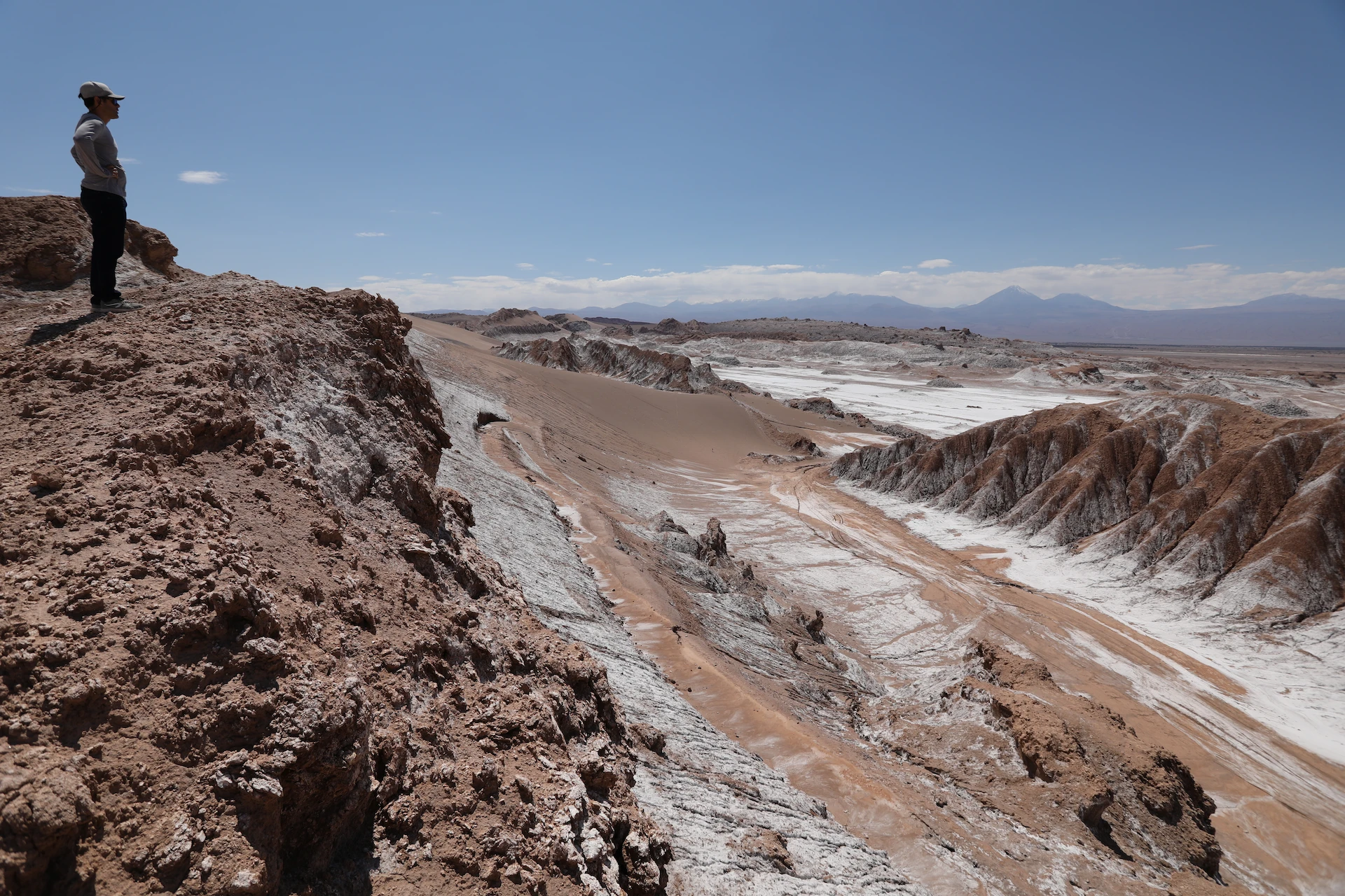
As soon as you take the road between Calama and San Pedro de Atacama, you will find this mineral universe, sometimes with vast views of the Cordillera de Domeyko, the Cordillera de Sel or further on the Cordillera De Los Andes and its line of volcanoes that approach 6,000 meters above sea level: the Licancabur dominates San Pedro and on both sides the Putana and the Laskar blow their fumaroles. Between these panoramas, valleys, basins or deep faults, and finally the vast Salar de Atacama: we enter the highest and driest desert in the world. It is also the oldest, forming 150 million years ago. The humidity is only 2 or 3%, and in some areas, it has not rained for 20,000 years. These conditions make it the best place in the world to find meteorites.
In fact, it extends much further north, towards Arica, and 800 km further south, around Copiapó.
We also wondered: where do these jeeps with a big red flag go?
– Copper mining: Chile is the leader with more than 30% of the world’s production.
In the largest open pit mine, Chuquicamata, excavated at more than 800 meters, about 180,000 tons are extracted daily. Other mines are underground with miles of drifts.
The other riches of the region are salts of volcanic or telluric origin: only lithium (so useful for our batteries, for example) covers the costs of extracting copper, molybdenum, saltpeter (nitrates) and also gold and silver.
The second resource is tourism:
Travelers from all continents are attracted by the geographical curiosities: the Valley of the Moon where you pass between cliffs and narrow gorges, then in front of spectacular dunes, the Rainbow Valley (Rainbow) whose colorful rocks have justified their name, the gorges of Catarpe or Guatin, the high-altitude lakes with strange colors (Tuyajto, Aguas Calientes, Menica or Miscanti…) and for geological curiosities: volcanism and its phenomena such as the geysers of Tatio. They also come to discover the high-altitude wetlands of Putana or Tocorpuri with their populations of flamingos, coots, Andean gulls, chululus; vizcachas, vicuñas or rheas that run along the slopes.
Thanks to the extreme drought, the high altitude and the exceptional insolation they can also see the vast fields of photovoltaic panels (146 MW are produced at the EDF Bolero plant), and they can access astronomical observatories: the Very Large Telescope at Cerro Paranal, or the giant European ALMA telescope. The low light pollution allows you to participate in very interesting evenings of stargazing, planetarium or galaxy observations.
History may also be of interest to them.
Originally, further north the Aymara and Quechua settled on the coast the Changos were fishermen. The Atacameños, a people of farmers or cattle ranchers, settled in the region watered by the San Pedro River. Its terraced crops have left their mark, their villages, exchanging relays with other regions as well, for example, Tulor (between 800 B.C. and 500 A.D. B.C.).
Others were protected by walls, such as the Pukara of Quitor (dating from the 12th century).
Climate change and the wind that moves the dunes have already caused the abandonment of these oases.
They were occupied by the Incas before the arrival of the Spaniards in the early 16th century.
The province became Chilean after the War of the Pacific (1879-1884).
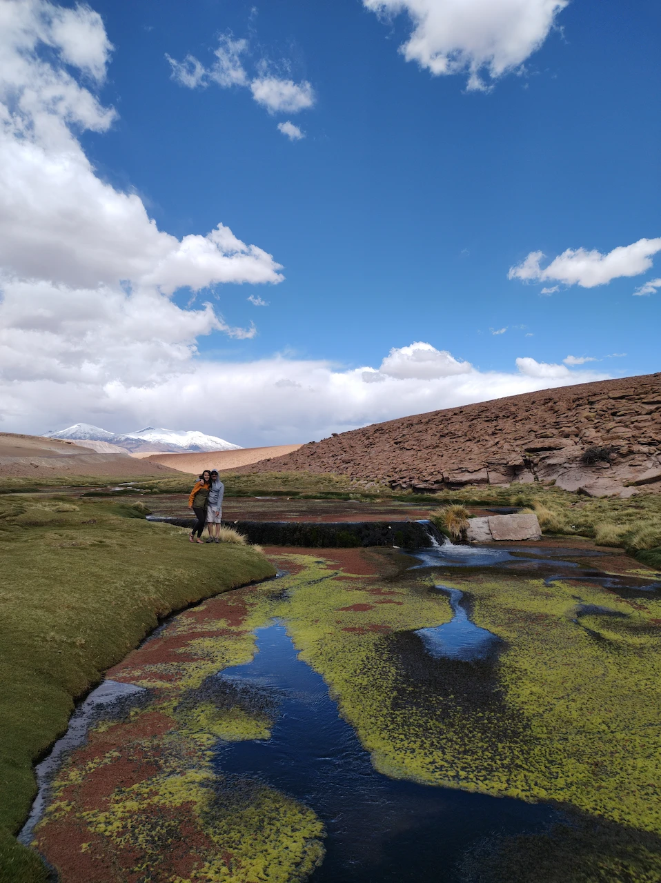
Today, there are about 30,000 Atacameños in the entire Antofagasta region, which has more than 600,000 inhabitants.
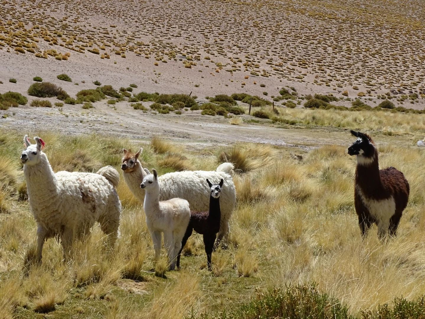
Today we pass through villages and hamlets, where the Ayllus (agricultural communities) harvest the fruits of the chanar, dried plums, carob and corn. There is irrigated horticulture and breeding of camelids (llamas) and sheep on temporary or salty pastures.
In San Pedro, don’t miss the meteorite museum before taking an interest in ancestral and contemporary crafts: stone, gold or silver jewelry, wool, fabrics, ceramics.
The mysterious Easter Island.
We arrive at this small volcanic island of 164 square kilometers, 23 km at its greatest dimension, at Mataveri airport. It has only 2 connections: Santiago, which is 3759 km away, and Papeete, which is 4254 km away.
Its long runway was set up as an emergency landing for the American space shuttle, but that never happened.
The nearest inhabited island, Pitcairn, is more than 2000 km away.
The human settlement of Easter Island is not precisely determined, between the 5th and 13th centuries… The only certainty is that it was carried out by sea from other Polynesian islands.
This small island, annexed by Chile on September 9, 1888, could serve as an example of what is currently happening on a global scale: massive deforestation and the depletion of natural resources.
In fact, various studies and theories speak of forests, especially a variety of palm trees, reduced to almost nothing today: as the population grew, wood was used more massively to build houses, canoes, utensils, and for heating and cooking. Soil tests also revealed traces of slash-and-burn to free up space for cultivation.
What really happened? It’s part of the island’s mysteries…
From there, we head to Hanga Roa: the capital with more than 7300 inhabitants located between two extinct volcanoes: Rano Kau and Maunga Terevaca.
Maunga Terevaca is the highest point on the island: you can go up on horseback to enjoy a 360° view.
Nearby is the Ahu Tahai: one of its platforms supports 5 more or less truncated statues.
In the city, you should not miss the Father Sebastian Englert Anthropological Museum (missionary of Bavarian origin) founded in 1973: it teaches us a lot about social, political and cultural organization, ancient writing and the first king Ariki Hotu Matua.
You can also sign up for a dive (even for beginners) to admire the species in the crystal-clear waters off the coast.
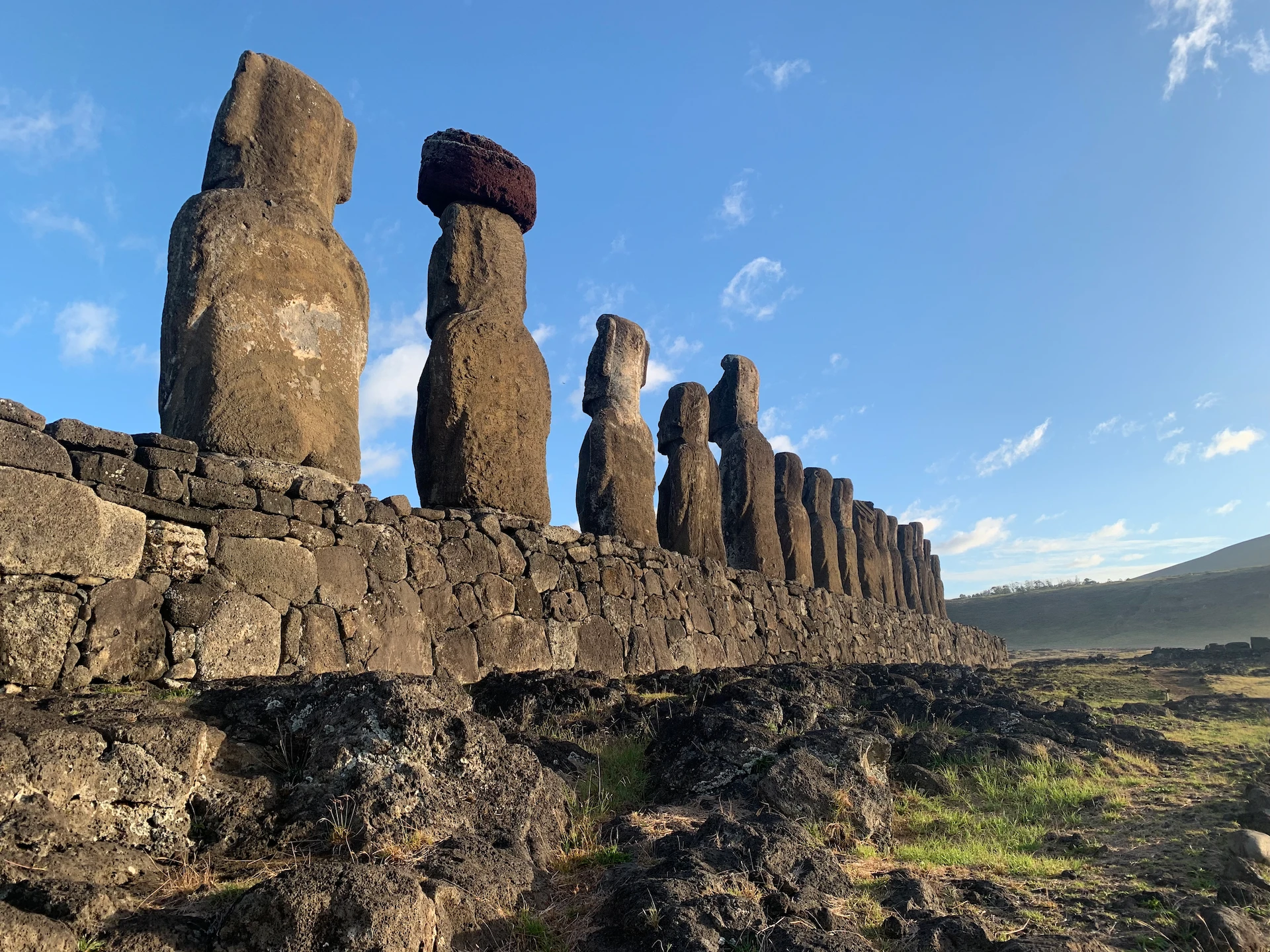
Of course, what makes Rapa Nui (the local name) famous are the moai, the iconic figures.
Depending on the site, they reflect different techniques, profiles, and eras in which they were erected between the thirteenth and eighteenth centuries.
They stand on the AHU, ceremonial platforms, looking inward, towards the village they were supposed to protect from the dangers of the ocean. One exception: the Ahu Akivi, where the people must have been between them and the coast.
Their eyes are made of white coral, the iris black of obsidian, and the headdress of red tuff from the Puna Pau quarry: some still possess all these attributes. All over the island, people are interested in its history, its shapes, its different platforms and its state of conservation.
In the Ahu Hanga Te’e, the Ahu Hanga Pokura the moai collapse or are destroyed.
The Ahu Vinapu is a platform of huge carved stones; A collapsed body was planned for 2 heads and the site was later used as a tomb whose entrance can be seen.
In Akahanga the colossi have collapsed, but the remains of a village remain with the foundations of the “boathouses” that have in front of them a small square, like a terrace of round cobblestones and a chimney. This is the tomb of King Hotu Matua. In Ahu Huri, in the interior of the island, the moai is the only one with 4 hands. It is called “the Astronomer” and served as a solar observatory. On the northwest coast, in the bay of La Pérouse, a curious circle of stones opened in alignment with the constellation of the Pleiades at the winter solstice, Pito Kura, is called the Navel of the World.
You then reach Ature Huki standing alone on its pedestal and Nau Nau, a beautiful resort overlooking Anakena Beach.
Let’s save for the longest of the structures, between 100 and 200 meters, the Ahu Tongariki and its 15 moai. It refers to the easterly winds.
It is close to the Poike volcano, the site of the legend of the Great Battle between the “Long Ears” and the “Short Ears” in the 10th century. In fact, not all moai on the island have identical ears!
And it remains to discover the great extraction center of these giants: the slopes of the Rano Raraku volcano.
The giants, scattered downwards, with the only specimen kneeling and those who are still lying down and have not completely detached themselves from the rock, call to us. What happened to cause the “work” to be interrupted in this way? Or is it a protected sanctuary of the old cult before the transition to a new one?
In fact, the cult is changing and so are its art forms.
The Birdman is carved in the form of petroglyphs into the rocks of the Rano Kau volcano. Whoever deserved the title had to swim to Moto Nui Islet, retrieve an egg from the Dark Tern, bring it back intact, and climb the volcano’s cliff to the site of Orongo.
Its depiction can also be found in the form of eighteenth-century cave paintings in the caves of Ana Kai Tangata where, among other things, the dead were entrusted to the ocean.
This Rapa Nui civilization almost disappeared after the gradual arrival of Europeans between 1770 and 1786. It was Dutch explorer Jacob Roggeveen who first stopped on April 5, 1722 (Easter Day).
The new epidemics, slavery, reduced the population from 3500/4000 to 110 souls! Today, about 50% of the island’s inhabitants are his descendants. The language is once again taught in schools and traditions are perpetuated in cultural events and sports competitions.
The central region.
When you arrive by plane in the central region, before landing in Santiago, you first have a view of the Andes Mountains, with the imposing Mount Aconcagua. It is located in Argentina 13 kilometers from the border and culminates at 6961 meters above sea level: it is the highest mountain outside Asia.
Depending on flight conditions, you can also take a detour near the Pacific coast and see Valparaiso.
Shortly before the finish line, we flew over valleys of fruit or wine crops and some mining deposits: copper again, but also gold, lead, gypsum, limestone and lime.
And we approach the capital, with its great towers, its hills, more than 6 million inhabitants. (9 million in the region and 19 million in Chile)
Once on land, we will visit it in more detail.
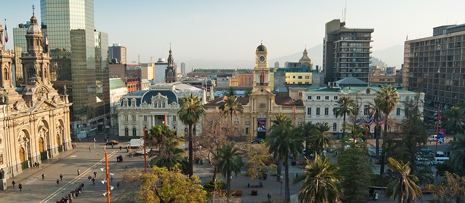
Santiago
Let’s start with the Plaza de Armas in the historic center and the Cathedral of the Assumption of the Blessed Virgin. It was built by Joaquín Toesca between 1748 and 1880, in neoclassical style; The interior has beautiful painted stucco vaults.
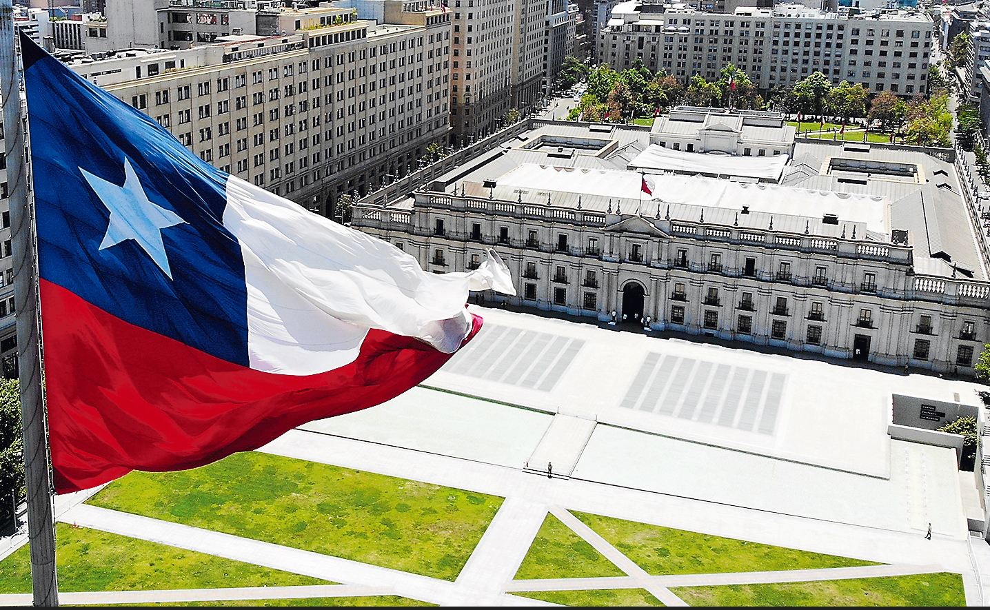
Let’s take a walk to the Palacio de la Moneda, maybe at the time of the changing of the guard? Then to the Central Station: it was first built by Gustave Eiffel, completed in 1885; Soon insufficient for the growth of traffic, it was enlarged and remodeled by the Schneider company. The new hall with its beams, built in Chalon-sur-Saône, was completed in 1897.
Then, two neighborhoods deserve a stop: the Lastarria neighborhood and the Parque Forestal: in this tourist and gastronomic district, we find the National Museum of Fine Arts and the Museum of Contemporary Art rich in cultural activities.
From Cerro Santa Lucía you can get a general view: the old chimney of a volcano with the Hidalgo Castle on its summit and several monuments along the way such as the fountain of the Circular Courtyard and the statue of Pedro de Valdivia.
The Bellavista neighborhood: it is known as a “bohemian” neighborhood with its restaurants, shops, art galleries, bars and nightclubs.
Artists such as Pablo Neruda live or have lived there.
From here, you can take the funicular to Cerro San Cristóbal. At the top, near the Sanctuary of the Immaculate Conception, you have a beautiful overview of Santiago and since 1920 you can visit a zoo.
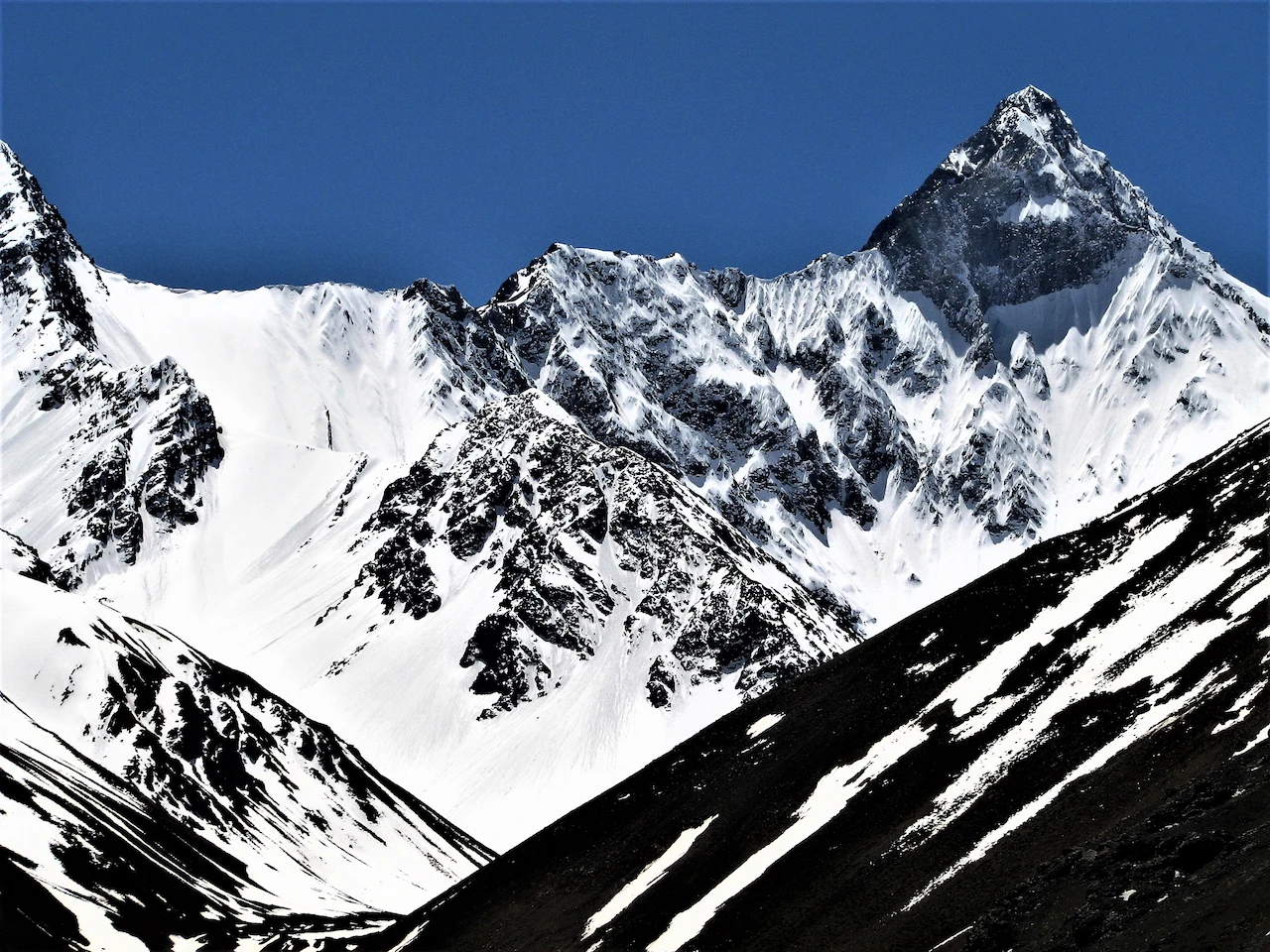
The climate, fauna and flora of the surroundings
It is a Mediterranean and continental climate due to its location between the Andes and the Coastal Range. Winters are mild and rainy, summers are dry, hot, even scorching.
Nature has developed sclerophyllous (hard-leaved) trees, such as palms, carob trees, lingue, and coigüe. Foxes, pumas, eagles and quail can be spotted.
Let’s go a little further south.
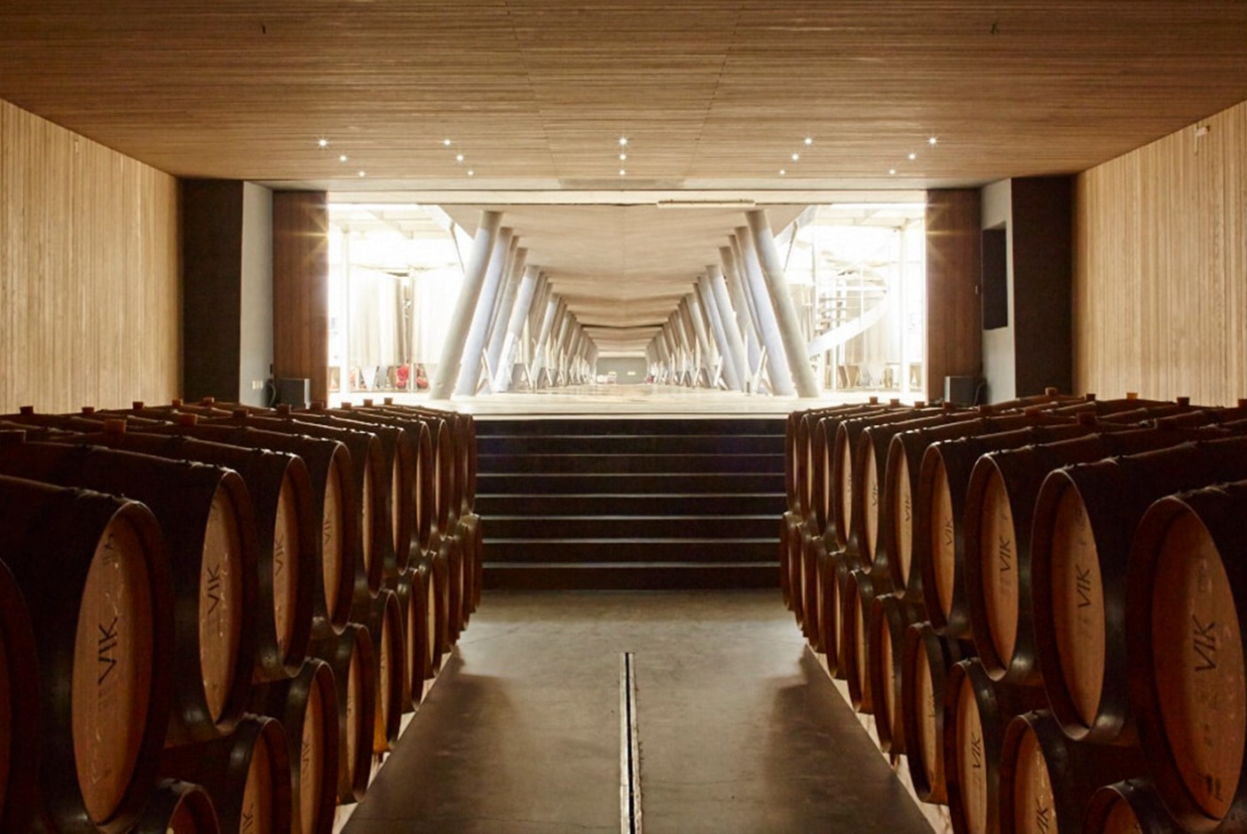
Maipo Valley
It is one of the oldest wine-growing areas in Chile. It mainly produces Carmenere and Cabernet Sauvignon, introduced by the first French immigrants in the 19th century.
A little further on, about 150 kilometers, we arrive at the Colchagua Valley. It is a narrow valley that stretches from the foot of the Andes Mountains to the Pacific with the cities of San Fernando and Santa Cruz. 910,000 hectares spread over 14 municipalities produce Cabernet Sauvignon, Merlot, Carmenere and Malbec.
And nearby, from Rancagua, you can visit the El Teniente mining site on weekends: of course, just a kind of museum that shows the history and living conditions of the miners in a rugged town. The mine itself consists of 2400 kilometers of underground galleries – it is the largest mine in the world.
Let’s go back to the west, a region of agricultural, livestock and forestry production. Wheat, corn, oats, vegetables such as garlic, onions, asparagus, and avocados are grown.
And with fruit, we reached records: more than 3 million tons exported per year: 70% of fresh fruit, especially cherries and plums; second, blueberries, nuts, and oats; thirdly, fresh grapes and hazelnuts; Then come peaches, apples, and pears. 10% of nuts and 20% of juices, oils, preserves and frozen products complete these exports to North America, Asia and Europe.
We go northwest, to cross the Casablanca Valley.
Its climate, cooled by the proximity of the Pacific and the Humboldt Current, favored the development of Chardonnay and Sauvignon Blanc grapes, as well as the very aromatic Pinot Noir. In the 1980s, 3600 hectares were planted.
Valparaíso
The most important port for the export of all these products and the historical records are reached with forestry, fishing and shellfish production. Seen up close or from the heights of the hills, the cargo ships and stacks of containers are breathtaking.
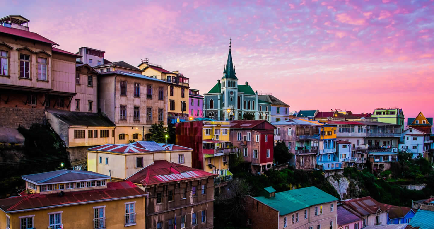
But it is also a city of more than 295,000 inhabitants that is very interesting to explore. 42 hills, or hills, were gradually populated as the port district became saturated. It can be reached via steep alleys, stairs or funiculars.
Each one bears its own architectural mark and murals. Let’s mention some of them:
Cerro Alegre: started by the English merchant William Bateman, it was remodeled after the earthquake of 1906.
Nearby Cerro Concepcion offers many restaurants, inns, and art galleries. The Atkinson Walk is made up of 19th-century Victorian-style houses, and you can visit St Paul’s Anglican Church, built in 1858.
Cerro Bellavista offers breathtaking views. It is home to the Sebastiana, one of Pablo Neruda’s houses, now converted into a museum. The Open-Air Museum is a collection of murals by Matilde Pérez, Roberto Matta, Nemesio Antúnez.
Since 1999, Cerro Carcel, where the Valparaiso prison was built, has been converted into a cultural center with theater, library, exhibition halls, shops and art workshops.
Let’s head out a little bit to the north, right next to it.
Viña del Mar
Etymologically, vineyards by the sea.
But in 1855 the first trams arrived there and in 1878 a new city was officially founded.
In 1929, President Carlos Ibáñez del Campo ordered the construction of a summer palace there.
Today it is a coastal city of about 332,000 inhabitants.
In 1960, the International Song Festival was established there, which is held every year in February. It is now held in the Quinta Vergara amphitheater, built in 1963 and renovated in 2002. In 1962, Sausalito Stadium hosted the FIFA World Cup.
On Avenida de la Costa, the Quinta Vergara, a sumptuous Venetian-style palace built in 1910, houses the Museum and School of Fine Arts.
The Tropical Plant Park was created by Doña Dolores Pérez de Álvarez and especially by her son, who brought plants from Oceania and the Far East from his travels.
Nearby, you can also see the flower clock.
Another place worth visiting 45 kilometers south of Valparaiso is:
Black Island
The area has been inhabited since the last ice age, around 11,000 B.C., by hunter-gatherers-fishermen.
There are vestiges of a more recent agrarian period, the Bato and Llolleo cultures, and then, in the 15th century, the Spaniards arrived.
In 1937 Pablo Neruda moved there, finding a residence in 1938 that he had modified in 1943. Today, this house is a museum where you can find a collection of figureheads.
The town has also hosted Violeta Parra, the architects Marta Ibáñez and Tito López, the singing groups Los Blops and Chancho de Piedra.
The Lake District
Entering the Lake District from the north means entering Green Patagonia.
A bit of history
Nowadays there is a lot of talk about migrants… But since his appearance on Earth, has man not always been a migrant?
It is assumed that South America may have had inhabitants 40,000 years ago; what we know for sure is that, after crossing the Bering Strait, some of them descended into the territory of present-day Chile 10,000 years ago: they are, for example, the Mapuche Huilliche or the Chonos.
In the 16th century, on November 1, 1520, the Portuguese navigator Magellan, on the initiative of King Charles I of Spain, was the first European to arrive there.
Attracted by the legend of El Dorado, in 1535, Diego de Almagro began the conquest of the territory, but in the south, the Mapuche resisted, and the conquistadors abandoned the place; until the eighteenth century, they remained only on the island of Chiloé.
As they had had time to see the advantages of this area for agriculture, they returned using the access from the south of British ships.
In 1683, the abolition of slavery did not prevent the continuation of the clashes and the fierce resistance of the Mapuche… One of the longest “wars” in human history.
Gradually, Chile reclaimed its independence; it was proclaimed on September 18, 1810, but Bernardo O’Higgins did not obtain it until 1818.
In the second half of the nineteenth century, the Chilean government encouraged the settlement of new settlers: many German families arrived.
In very difficult conditions, facing a hostile nature, these people are deforesting to develop agricultural land and build new cities, for example, Puerto Varas.
An earthquake on May 22, 1960 (9.4 on the Richter scale) was followed by a tsunami that flooded several coastal cities and awakened several volcanoes.
Climate
It is a humid region, with maximum rainfall between June and September, i.e. winter, but it is never very cold.
Economy
Agriculture and livestock play an important role, but so do fishing and salmon farming (many of which can be seen on the Pacific coasts).
And the second source of income is tourism.
Top Attractions
They’ll deserve a more detailed description as the programs progress, but here’s a first “fresh”:
Green Patagonia is synonymous with National Parks: primary forests with all kinds of species of oaks, Antarctic beeches, Chilean cedars, giant larches, ulmos, notros… in the Puyehue, Vicente Pérez Rosales, Pumalín, Alerce Andino parks…
In these parks it is also possible to observe fantastic fauna: you can have the opportunity to meet the huemul (deer family), the pudú (the smallest of this family), the gray fox, among others, and all kinds of birds, such as flamingos, parrots, queltehue, ibis or chucao.
In these parks, there are also many hot springs where it is very pleasant to relax.
Of course, don’t forget about the volcanoes around which you can hike beautifully, or even reach the top:
The most famous are the Osorno Volcano and the Chaitén.
Historical heritage
In the Chiloé archipelago, it is mainly made up of the Spanish forts of Ahui and Ancud, and above all by the churches classified as a UNESCO World Heritage Site: the most famous is, of course, the one in Castro.
In Castro you should not forget the visit to the stilt houses.
Northern Patagonia
You could say “the Patagonias”, because with more than 500 kilometers between the north and the south, the landscapes change according to climatic differences and forms of land use.
The Pucón Region
It is a city of about 25,000 inhabitants on the shores of the beautiful Lake Villarrica and at the foot of the Villarrica Volcano, in Araucanía.
You can feel the influence of European settlers, mostly Germans, who have developed cattle ranching and logging and then tourism since the 1930s. It is the most important lake resort in Chile, with nearby spas and a ski resort.
Around it, you can visit different sites: Huerquehue National Park.
The Eyes of Caburga with its turquoise waters and waterfalls.
El Cani Sanctuary: Conservatory of the Andean Temperate Forest.
Access to the Villarrica Volcano allows you to sometimes see wild boars and deer, but above all to visit the Museum of the Volcanoes and the Lava Cave.
Further east, we really get into Mapuche territory. First in the Palguin Park and its waterfalls, for example, the cougar.
Other excursions are possible through the Monsignor Francisco Valdez Subercaseaux International Route: In Curarrehue: In this town you can visit an artisan weaving factory.
Further on, as you gain altitude, you pass through araucaria forests and magnificent panoramic views towards mountains and lakes before reaching the Mamuil Malal Pass.
Under the silhouette of the majestic Lanín Volcano, is the border with Argentina.
If you wish, an interesting hike to Lake Huenfica allows you to observe many species of plants.
The Puerto Varas Region
We are in the Lake District. The city’s population continues to grow and exceeds 45,000 inhabitants. “The City of Roses”, on the shores of the 2nd largest lake in Chile, Lake Llanquihue, was founded in 1854 by settlers mainly from Germany. There is a lot of architectural and gastronomic influence. On the outskirts of the city, the Felmer Museum tells the story of the difficult conditions in which they settled, with photos and an exhibition of objects and equipment: people invited by the Chilean state to develop previously unused territories.
In the city, the Pablo Fierro Museum also offers beautiful collections of objects and photos about the history of the city, including the aftermath of the 1960 earthquake: the strongest in history with 9.5 on the Richter scale. It is located on the shore of the lake and you can enjoy beautiful views of the Osorno Volcano, Calbuco Volcano and Mount Tronador.
We are in a region of various cereal crops and livestock that we cross during the various excursions: the region is the 1st producer of dairy products and meat. But the main activity today is salmon farming, which is Chile’s 2nd largest source of exports.
In the Vicente Perez Rosales National Park, we have several destinations and types of activities: Around the Osorno Volcano there is an easy hike to the site “Las Cascadas”. A little further on, you can choose a zip-line descent of more than 2 kilometers in several stages with Canopi.
We can go up to the Teski Refuge and the Red Crater.
From La Picada, a beautiful hike allows you to go around it through the Soledad Pass and descend to Lake Todos los Santos with a boat back to Petrohué.
There are other proposals: Possibility of rafting on the Petrohué River.
A little further down, a visit to the Petrohué Waterfalls.
From Ralun, a hike leads to Cayutue Lake.
On the shores of Lake Llanquihue, about twenty kilometers away, is Frutillar: the city has been classified by Unesco as a “Creative City of Music” thanks to the Teatro del Lago that offers shows of the first international level, which houses schools and works with others in the region. You can also enjoy craft beers.
Puerto Montt, the large nearby city that must now have 250,000 inhabitants, receives the main planes at Tepual airport and the smaller ones at La Paloma.
Along the way, you can visit the Lahuen Nadi Natural Monument to get up close and personal with the native trees. On the edge of the Pacific coast, at the Angelmo Market, a hundred shops offer local handicrafts, seafood, charcuterie, cheeses, and local products such as garlic and rhubarb, not to mention several restaurants.
A little further south, you can dedicate half a day to the Alerce Andino Park: a beautiful immersion in a native forest with larches or ulmos several hundred or even millennia old, coigües (nothofagus), cinnamon, laurels or myrtles. From here you can also go to Lake Chapo with its “forest” of logs frozen by an ancient eruption of the Calbuco Volcano: the “stumps”.
If you want to go further across the Reloncaví estuary, you will arrive at Cochamó. On the way we pass by the Yates Volcano, we can stop at the viewpoint of the volcanoes and near the town of Puelo enjoy the Thermal Baths of the Sun.
The Chaitén Region
Further south and taking the ferry to Hornopirén, after a 5-hour crossing, you can reach Caleta Gonzalo.
Right next door, the Alerces Trail also allows you to immerse yourself in the primary forest and see how it is renewed.
If we continue the path, we stop at the foot of the Chaitén Volcano: a hike of very medium difficulty with a difference in altitude of 600 meters leads to the crater and we see how nature has regained possession of the slopes since the last eruption in 2008.
Before reaching the city, Santa Barbara Beach offers beautiful views towards the Corcovado Volcano. You can also see different seabirds.
Even further south is located along Lake Yelcho. A little further on, an interesting hike allows you to observe the forest, the plants and flowers of the undergrowth, the mushrooms, the giant rhubarbs before reaching the viewpoint of the Ventisquero Yelcho: a glacier divided into two “tongues”.
Another excursion that is offered, depending on the length of stay in the area: A little further on, we arrive at Villa Santa Lucia. On December 16, 2017, this village was hit by alluvial runoff caused by heavy rains and the collapse of a glacier. The Site Museum “La Casa Bandera” traces this disaster.
The Chiloé Archipelago
It is interesting and rich in natural environment, architectural heritage, history and agriculture.
In the past, the Chilotes contributed to the settlement of settlers in the Lake District through labor, showing how to use yoke of oxen, providing seedlings: for example, the many varieties of potatoes existing on the island. Today, agriculture and livestock are still present.
What you can visit in Chiloé: The Ancud Museum that covers all this past.
Near the north, Fort Ahui is one of the last bastions of Spanish resistance during Chile’s independence.
In the same area, there are sailings to the islets of Punihuil to observe penguins and other marine animals.
If we continue the route, we cross the Big Island to reach Dalcahue: a small and beautiful fishing port quite lively. It is the starting point of several destinations: The island of Quinchao with the towns of Curaçao de Vélez and Achao.
The Rilan Peninsula.
In these places, in addition to the landscapes, especially towards the imposing Michinmahuida Volcano on the mainland, there are several wooden churches all classified as UNESCO World Heritage Sites.
Of course, the main town, Castro, is worth a visit with its set of colorful houses on stilts, the “stilt houses” and possibly the most notable church with its light wood interior.
If you want to go further south, you can get to Chonchi to get to Lemuy Island, then Cucao Natural Park or Tepehueico Natural Park.
You can go to Queilen for an interesting navigation: there everything is explained after a good lunch about the history of the islets, the landscapes and from April to June you can observe whales and from October to March penguins, other birds and dolphins. To return to the mainland by going up the coastal road from Dalcahue, you can make a stop at the Tocoihue waterfalls.
From Southern Patagonia to Antarctica.
At the tip of the continent, on the other side of the Southern Ice Field, which covers 16,800 km2 with its 49 glaciers, Southern Patagonia offers two different faces.
Near Puerto Natales, the most "continental" way.
This small town of about 20,000 inhabitants is located on the shores of the Last Hope Fjord. The first explorers had a hard time getting out of the labyrinth surrounding the Strait of Magellan.
From there, several explorations of a powerful nature are possible that bring us back to humility.
– A day trip allows you to sail along the Balmaceda Glacier and then make a stopover to first cross on foot a forest reserve of lengas, cinnamon trees, crushes (nothofagus) among others, observe a very varied flora in the undergrowth and reach the lagoon where the Serrano Glacier emerges.
– Another excursion leads to Lake Grey (its waters are grey) and to approach the Grey Glacier by boat.
– You can go to other lakes in the area: Sofia Lake, Pehoe Lake, Nordenskjöld Lake, Sarmiento with different colored waters. Several viewpoints offer beautiful viewpoints and, for example, at the Condor, you might have the chance to see this majestic bird.
– In the Paine Massif National Park, interesting for its geographical shape, flora and fauna, a 2-hour hike leads to the foot of “Cuernos”. you can admire the Blue Lake and the Toro Lake, the largest of them all.
On the way through a wild pampa we met rheas, guanacos…
– In the Sierra Baguales, it is interesting to visit, or stay there if you wish, the Estancia Las Cumbres: a look at the local agricultural world, dedicated mainly to sheep breeding.
– Prehistoric enthusiasts, don’t miss the Mylodon Cave: a herbivorous mammal that became extinct during the Pleistocene.
From Punta Arenas
both the historical approach and the more “seafaring” way.
It is a city of more than 130,000 inhabitants officially founded in 1848. Surprise! It is 60 km further south where there is a monument that marks the geographical center of Chile: it takes into account the Chilean territory in Antarctica.
At first, the prosperity of the city developed with the wool trade; Now the port activity dominates, still with wool, but canned goods, fishing, wood and its derivatives, and of course tourism and cruises have been added.
Let’s start with the historical tours:
– These are the ruins of the King Don Felipe City and the Port of Hunger.
In fact, due to the harsh weather conditions and lack of food, many settlers died there.
– Fort Bulnes was rebuilt in 1843 on the remaining foundations of the old one. There are walls made of logs, filled with a tangle of roots and compacted soil that helped fight the cold and humidity. There are still cannon batteries and you can visit the prison.
– At the Detroit Museum we discover this story: President Manuel Bulnes wanted to control the strait, but due to the conditions of this inhospitable land the site was abandoned after 6 years to settle on the site of Punta Arenas.
Let’s look at the “marine” environment:
We are going to sail through the Francisco Coloane Marine Park.
We will see birds: cormorants, petrels, albatrosses, Darwin’s penguins. We will be amazed by the “dance” of humpback whales, possibly the passage of dolphins and the apparent “nap” of sea lions on the rocks.
On Carlos III Island, a natural sanctuary of the fjords, we will be able to see condors as we walk along the trail through the native forest.
And we’ll head to the bay of the Fernandez Glacier: maybe we’ll hear the rumblings that accompany the collapse of the ice blocks?
Tierra del Fuego.
In Punta Arenas, a ferry connects to Porvenir: the large city of about 6,000 inhabitants of the archipelago. There is a monument to a community of Croatian settlers.
From there, we enter breathtaking territory: now navigators no longer see the fires (which are said to have been the origin of this name) lit by the Selknam.
We pass through huge sheep farming areas, but the population density is less than one inhabitant per km².
We pass by an old dredger left behind by gold prospectors.
And we met troops of guanacos and flocks of ibis, deer, and foxes.
In rivers or lakes, you can also see beavers and their constructions. They were introduced from Canada in hopes of wearing their skin, but the climatic conditions were not suitable for them, and it was not marketable. Thus, they have become an invasive and environmentally harmful species.
We also passed near an important center of the forestry industry: the Russfin sawmill, which is the last point to get fuel.
– It is possible to make a stop near the Hosteria Las Lengas (the lenga: beech of Tierra del Fuego).
Strolling through the Lac Blanc, under the trees inclined asymmetrically due to the strong winds, with garlands of lichens on their branches, you can see flowers and orchids (bluebells, lupins, popcorn-codonorchis…)
– If you go further, you’ll pass through swampy valleys and viewpoints overlooking the Darwin Range and its glaciers. We walked along Lake Deseado.
– Farther away, near Lake Fagnano shared with Argentina north of Ushuaia, bungalow accommodation can be found. And through a still unfinished track you reach Yendegaia and Admiralty Bay.
– The closest visit to Porvenir, on the coast of Bahía Inútil, is the King Penguin Park: an educational center about the birds of the area and observation posts to admire the colonies of king penguins, smaller but as colorful as the famous emperor penguins.
Cape Horn
Who doesn’t dream of “bending” Cape Horn, as they say in the sailing world? This rocky islet that dominates the ocean for 425 meters is a World Biosphere Reserve. The first navigator to cross it was Willem Schouten in 1616. He named it after his hometown in Holland.
Currently, cruise ships lead to it, but disembarkation is random depending on weather conditions.
Antarctica
This immense continent of 13 million km², covered by a layer of ice, reaches an altitude of 2,000 meters at its center. It is divided among several states that have established scientific bases on it. It is the largest supply of fresh water on the planet.
The flora is limited to a few mosses and lichens.
The fauna is richest during the summer: whales, dolphins, killer whales, seals, penguins, albatrosses, cormorants, petrels returning north and less cold waters in the fall.